
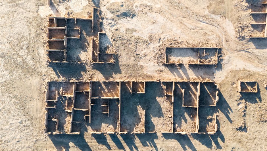
Archaeological Survey Services Using Advanced Drones
Archaeological research has significantly evolved with the integration of cutting-edge technologies. Among these, the use of aerial platforms such as drones has revolutionized the way surveys and site assessments are conducted. Archaeological drone survey services now offer a highly efficient, cost-effective, and non-invasive method to explore and document historical sites. These services utilize advanced drone technology to capture high-resolution imagery, create detailed topographic maps, and uncover hidden features that might be missed during traditional ground-based surveys.
Advantages of Using Drones in Archaeological Surveys
Drones provide several key benefits for archaeological applications, including:
- Accessibility: Drones can reach difficult or hazardous terrain, allowing archaeologists to survey areas that are otherwise inaccessible.
- High-Resolution Data: Equipped with sophisticated cameras and sensors, drones capture detailed aerial photographs and 3D models.
- Cost Efficiency: Compared to manned aircraft or extensive ground surveys, drones reduce operational costs and time.
- Minimal Disturbance: Non-intrusive aerial surveys help preserve the integrity of fragile archaeological sites.
- Rapid Data Collection: Large areas can be mapped quickly, enabling timely analysis and decision-making.
Technologies Behind Archaeological Drone Survey Services
Modern archaeological drone survey services leverage a variety of technological components to maximize data quality and usefulness. These include:
- Surveillance drone capabilities: Equipped with thermal imaging and multispectral sensors, drones can detect subsurface anomalies indicative of archaeological features.
- High-precision GPS and UAV navigation systems: Ensure accurate georeferencing of collected data for reliable mapping and documentation.
- Photogrammetry software: Converts aerial images into detailed 3D site models, providing comprehensive spatial understanding.
- Data analytics tools: Assist archaeologists in interpreting the complex datasets generated during flights.
Understanding UAV vs Drone in Archaeological Context
In the context of archaeological surveys, it is important to differentiate between UAVs (Unmanned Aerial Vehicles) and drones. While often used interchangeably, UAV refers specifically to the aircraft itself, which operates without a human pilot onboard. Drones, on the other hand, generally encompass the entire system, including the UAV, ground control station, and communication links. Both UAVs and drones are critical in archaeological applications, but the broader drone system provides enhanced capabilities for mission planning, real-time monitoring, and data management.
Applications Beyond Traditional Surveying
Besides mapping and site documentation, advanced drone technologies have expanded the scope of archaeological work:
- Drone inspection: Periodic aerial inspections monitor site conditions, erosion, and human impact over time.
- Drone utility inspection: Used to assess infrastructure related to archaeological sites such as protective fencing and access roads.
- Drone security: Surveillance drones help safeguard sensitive sites from looting and unauthorized access.
These applications enhance the preservation and management of cultural heritage by providing comprehensive oversight and rapid response capabilities.
Future Perspectives in Archaeological Drone Surveying
As drone technology continues to advance, archaeological survey services stand to benefit from improvements in sensor technology, artificial intelligence, and autonomous flight capabilities. Integration with other remote sensing methods, such as LiDAR and satellite imagery, will further enrich data accuracy and site interpretation. Moreover, regulatory frameworks are evolving to accommodate increased drone usage, enabling broader adoption in archaeological research worldwide.
Harnessing Aerial Innovation for Cultural Heritage
Advanced drones have become indispensable tools in the archaeological field, offering unparalleled perspectives and data quality. Through archaeological drone survey services, researchers can uncover and preserve the stories of the past with greater precision and care. By embracing these aerial innovations, the cultural heritage community ensures that historical sites are studied responsibly and protected for future generations.
